Run:
Forecast Hour
New run available
Valid:
Parameter
Upper-Air: Height, Wind, Temperature
Height and Wind
Temperature and Wind
Surface and Precipitation
Surface
Precipitation Type
Quantitative Precipitation
Integrated Moisture and Satellite
Radar Products
Upper-Air: Dynamics
Temperature Advection
Severe Weather
Instability
Wind Shear
Composite Parameters
Explicit Convective Products
Combination Plots
Winter Weather
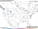
Snowfall
Snowfall (10:1 Ratio)
Snowfall (Kuchera Ratio)
Snow Depth
Ice
Interactive Features
Cursor readout
Click for sounding
Zoom menu
Hotkeys
previous forecast hour
<
next forecast hour
>
previous run
[
next run
]
toggle readout
r
Model ►
RRFS A
Zoom ►
Animation ►
Compare Models Slideshow
https%3A%2F%2F_%2Fmodel.php%3Ffh%3D12%26m%3Drrfs_a%26mc%3Dsl%26p%3Dsnku_012h-imp%26rh%3D2024051600
The RRFS A is a prototype NOAA run and not for decision making. It will post as available, and outages may occur. More RRFS details are available here.
Click/tap a thumbnail to begin the slideshow.
Mobile users: swipe left and right to advance through slides; swipe down to exit slideshow. (Hint: for correctly-sized images, make sure the page is zoomed out all the way before tapping a thumbnail.)
X


